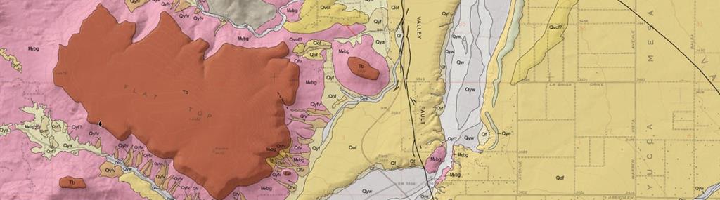
 Geologic Map. Partial view of preliminary geologic map of the Landers and Yucca Valley North
(northern half) 7.5’ quadrangles, San Bernardino County, California. Photo credit: C. Wesoloski and G. Marquis, CGS.
Geologic Map. Partial view of preliminary geologic map of the Landers and Yucca Valley North
(northern half) 7.5’ quadrangles, San Bernardino County, California. Photo credit: C. Wesoloski and G. Marquis, CGS.
Maps
The Mineral Resources Program conducts geologic mapping to characterize and assess mineral resources across California. In recent years, most mapping activities have been carried out as part of Earth MRI projects. Links to recent mapping products are provided below. For geologic maps in Mineral Land Classifications, please visit the Mineral Land Classification Page or the CGS Publications Request Page.
Data
The Mineral Resources Program collects rock samples for geochronologic and geochemical analysis as part of geologic mapping, geochemical reconnaissance, and Earth MRI projects. Analytical results are reviewed and compiled by program staff, and published data releases containing these results are linked below. For more information on critical minerals, please visit the Critical Minerals Page.
View and Download Geologic Data Products
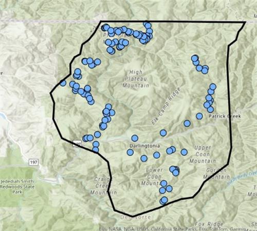
Del Norte Nickel-Cobalt Laterites
Web page by:
California Geological Survey - Mineral Resources Program
