3D Geologic Framework Models


3D geological modeling oblique block diagram
Figure 1: Block diagram depicting the 3D geologic framework model of the south-central San Joaquin Basin. Large-scale geologic sequences are distinguished by colors and dots represent subsurface correlation points. The model is shown in oblique view with 5 times vertical exaggeration. Click image to open a high-resolution version.

About 3D Geologic Framework Models

3D Geological Framework Models are static digital representations of subsurface geologic conditions. These models depict the regional geometry, distribution, and relationships of geologic units and structural features in three dimension and provide a scientific framework for visualizing subsurface geology.

These products may be used as visualization and educational tools to improve understanding of regional subsurface geologic conditions that may influence groundwater resources, carbon storage potential, geologic hazards, infrastructure planning, and other subsurface interests.

These models may also serve as foundational inputs for additional scientific and technical studies, including dynamic subsurface modeling applications.

The CGS Geologic Carbon Sequestration Data Portal provides an interactive map tool and links to related data products.


Explore the interactive 3D model of the Southern San Joaquin Basin by clicking and dragging within the panel below. Click on the different layers in the menu to toggle their visibility. Click here to open the model in a new tab.


Data Downloads

PSGM 25-01: Preliminary Subsurface Geologic Model of the south-central San Joaquin Basin

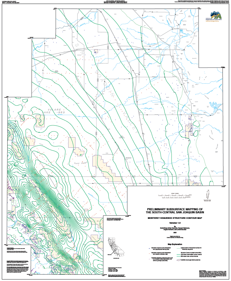
Monterey Structure Map
Monterey Sequence structure contour map from PSGM 25-01.

by Daniel Boyd, Brian Clements, Kazumi Nakamura, Angela Gerhardt, and Lennin Escobar

PSGM 25-01 represents the Preliminary Subsurface Geologic Model of the south-central San Joaquin Basin. Work on this project spanned from July 2021 to December 2025 and was in part supplemented through USGS STATEMAP funding. The results of this project will help inform methods for future California Geological Survey subsurface geologic mapping projects and support long-term planning and prioritizations of future projects across the state. Future subsurface maps and models will include assessments of potential carbon storage reservoirs to facilitate meeting the state’s carbon goals. PSGM 25-01 is a stratigraphically focused, 3D geologic framework model representing a conceptual interpretation of selected subsurface formations and sequence boundaries within the study area covering approximately 3,600 mi2 (9,000 km2) in the Fresno and Bakersfield 1° x 2° Quadrangles of the south-central San Joaquin Basin Province. Products developed for PSGM 25-01 include: ten structure-contour maps (Plates 1A to 1J), nine isochore maps (Plates 2A to 2I), a geodatabase, CSV file, gridded surfaces (Z-Map Plus ASCII, .XML), triangulated surfaces (GOCAD .TS), metadata files, and an executive summary. These subsurface maps are complimented by a surface geologic map of the study area (Gutierrez and others, 2025 - Plate 3), completed concurrently under a separate STATEMAP award.


Download Links:


Project Contact


Web page by:
California Geological Survey - Regional Geologic and Landslide Mapping Program

Last modified: 7/14/2026

‭(Hidden)‬ Custom CSS