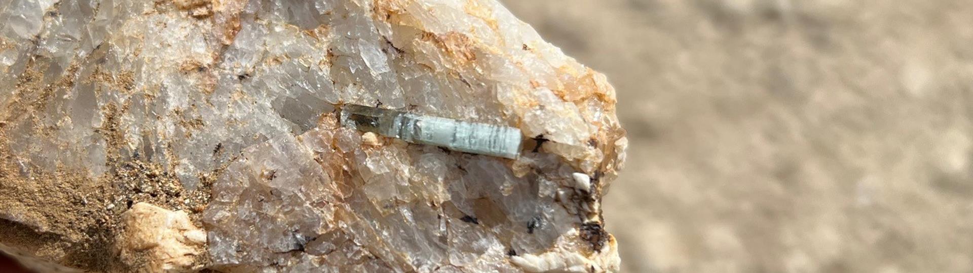
 Beryl.
Select the image to view full screen. Photo credit: D. Rigdon, CGS.
Beryl.
Select the image to view full screen. Photo credit: D. Rigdon, CGS.
A critical mineral is any non-fuel mineral, element, substance, or material that is essential to the economic or national security of the U.S. and has a high risk of supply chain disruption.
In 2017, Executive Order 13817 directed the U.S. Geological Survey (USGS) to develop and maintain a list of non-fuel minerals and mineral materials determined to be critical to the U.S. In 2018, the USGS released a list of 35 critical minerals. In 2022, the USGS updated this list to include 50 minerals. In 2025, the USGS updated this list, and the Final 2025 List of Critical Minerals includes 60 critical minerals (see below). Learn more by reading our CGS Note 58 on Critical Minerals.
2025 Draft List of Critical Minerals
Critical Minerals Projects
Earth Mapping Resources Initiative (Earth MRI) Projects
The U.S. Geological Survey (USGS) Earth MRI is an effort to modernize geologic mapping of the Nation’s surface and subsurface, with a focus on areas of critical mineral resource potential. Through the Earth MRI, USGS partners with State geological surveys, Federal agencies, private industry, Tribes, and universities to collect and share data that improves our understanding of the Nation’s geologic framework. Projects funded through Earth MRI include geologic mapping, geochemical sampling, and collection of new airborne geophysical, lidar, and hyperspectral data.
View and Download the Earth MRI Projects
Geologic Mapping in the New York Mountains Region
In 2019, the CGS entered into a cooperative agreement with the USGS to conduct geologic mapping of the New York Mountains in San Bernardino County at 1:24,000 scale. More ❯
This project was supported in part by funding from the USGS and occurred within the Mountain Pass Rare Earth Element Focus Area. The field area was selected due to its proximity to the world class, carbonatite-hosted, light rare earth deposit at Mountain Pass. This project aimed to gather information to identify potential domestic sources of critical minerals with a focus on rare earth elements. The following 7.5' quadrangles were mapped:
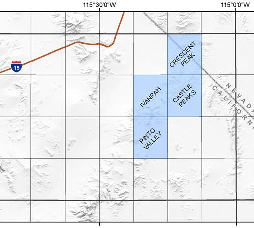
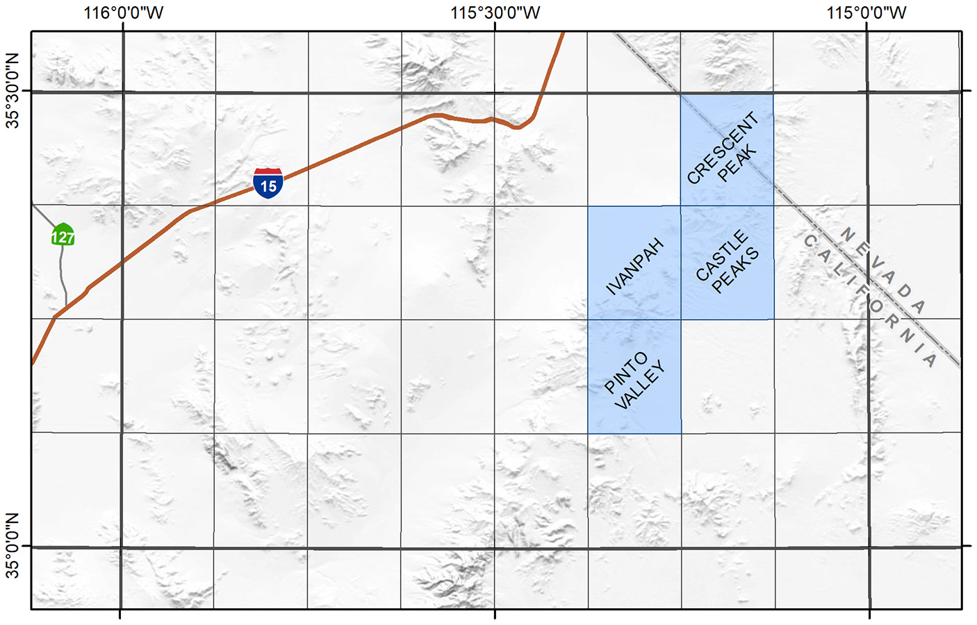 New York Mountains-Ivanpah Region.
Geologic Mapping in the Salton Sea Region
The Salton Sea Earth MRI project includes geologic mapping and geochemical characterization of rock units that could represent sources of lithium in the Salton Sea Geothermal Field brine. More ❯
Geochemical sampling included Tertiary volcanic, Mesozoic intrusive/metamorphic, and Quaternary sedimentary units. The project produced geologic maps and cross sections of the following three 7.5' quadrangles at 1:24,000 scale:
 Salton Sea Region.

Geologic Mapping in the Gravel Hills-Bristol Lake Region - in progress
This Earth MRI project is helping characterize the extent and variability of lithium enrichment within the Miocene Barstow Formation and equivalent age units through geologic mapping and geochemical reconnaissance. More ❯
The project is generating two new 1:24,000-scale geologic maps across the western Cady Mountains and Daggett 7.5' quadrangle in San Bernardino County in support of learning more about sedimentary-hosted lithium deposits.
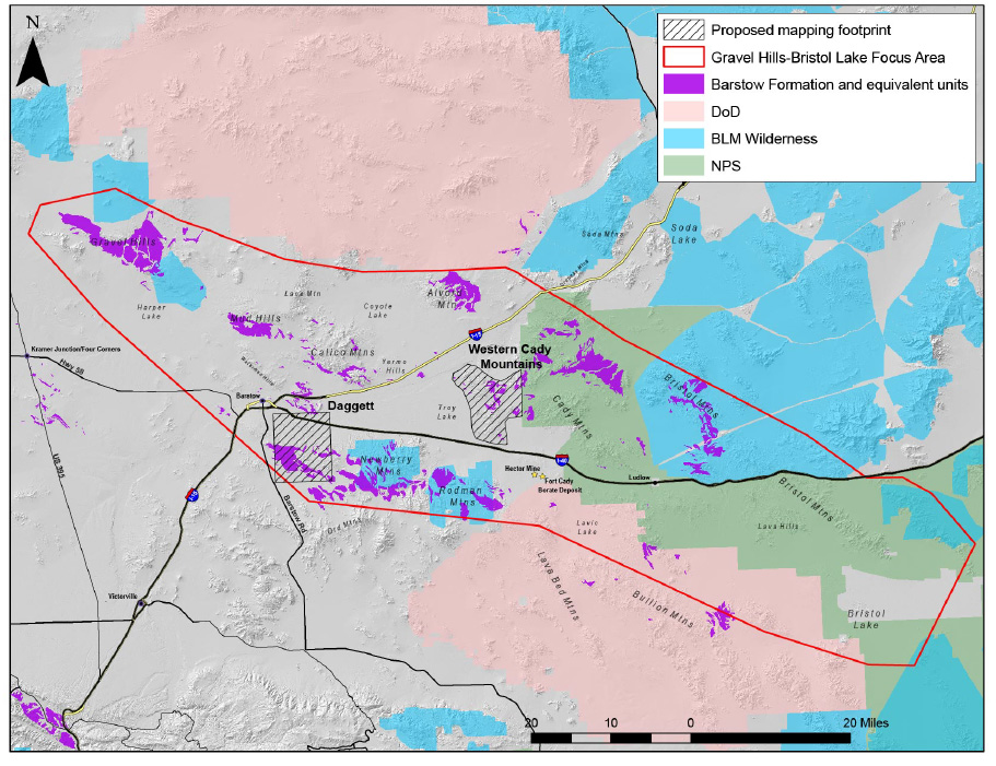 Gravel Hills-Bristol Lake Region - in progress.
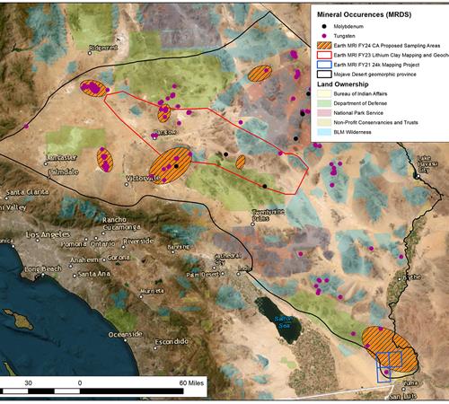
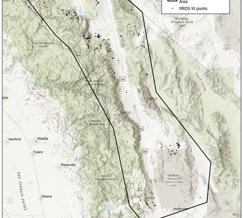
Geochemical reconnaissance of Mo-W deposits of southeastern California - in progress
This Earth MRI project is in collaboration with geological surveys from New Mexico, Texas, and Arizona. More ❯
The CGS MRP aims to develop a greater understanding of the rock geochemistry and age of molybdenum and tungsten (Mo-W) mineralization related to intrusive rocks in California as part of a potential Tertiary belt of Mo-W mineralization that stretches from west Texas to southeastern California. Information will be available here 2027!
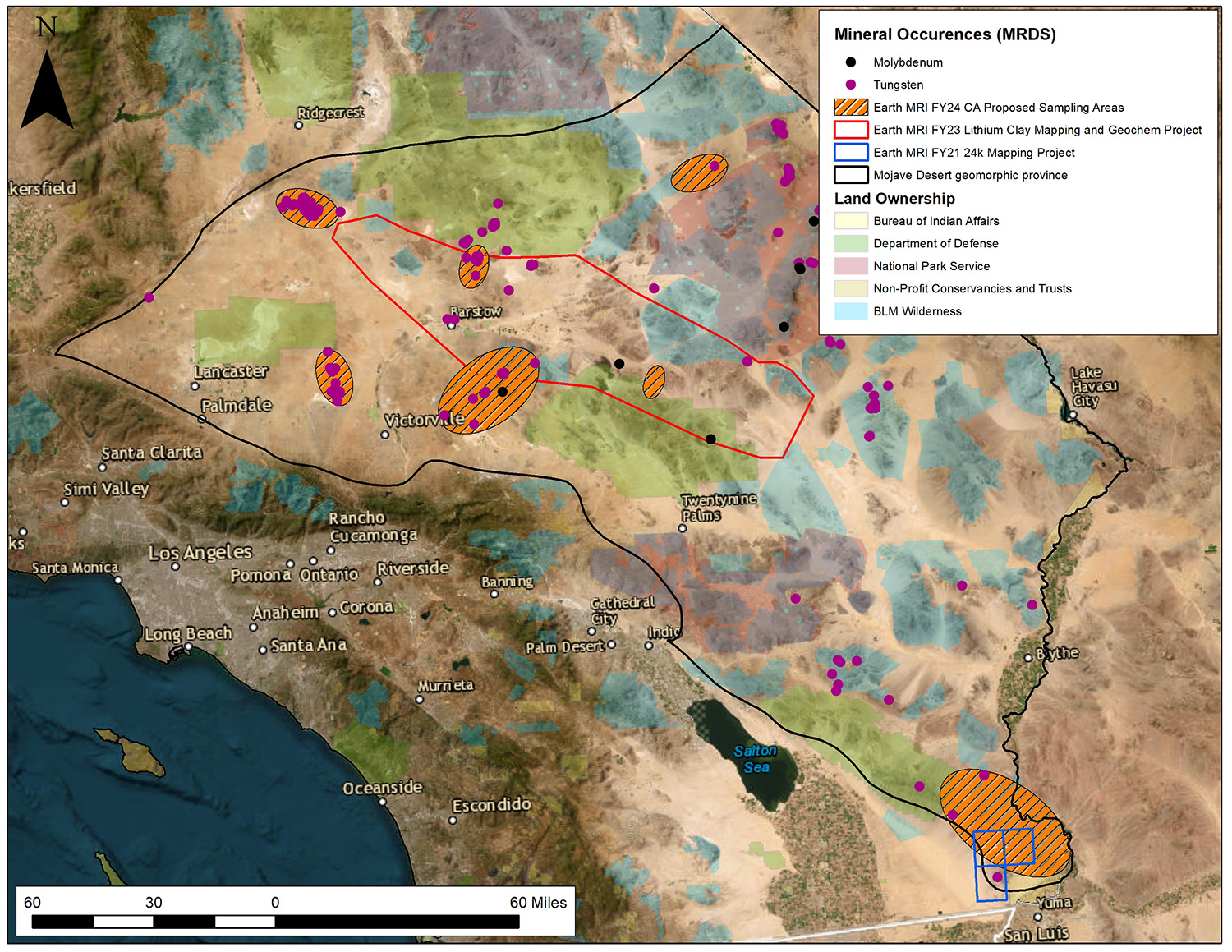 New Mexico Mo-W Study - in progress.
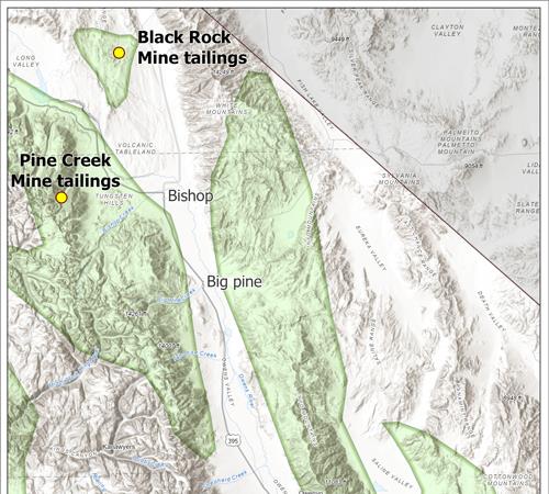
2024 Characterization of Mine Waste in Eastern California - in progress
This Earth MRI project aims to characterize processed mine waste at three sites in eastern California: Pine Creek Mine, Black Rock Mine, and Darwin Mine. More ❯
Pine Creek Mine and Black Rock mine represent tungsten skarn-replacement-vein deposits and host critical minerals such as tungsten, bismuth, manganese, and scandium. Darwin Mine represents a lead-silver-zinc polymetallic deposit that hosts critical minerals such as antimony, arsenic, bismuth, gallium, germanium, indium, manganese, tellurium, and tungsten. Final Technical Report - Coming 2026!
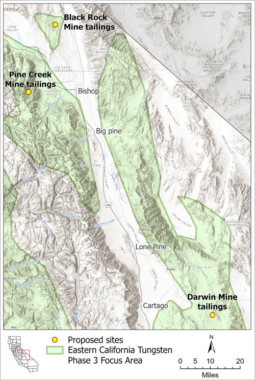 2024 Characterization of Mine Waste in Eastern California - in progress.

2025 Inventory for Mines with Critical Mineral Potential in Waste - in progress
The goal of this Earth MRI project is to inventory the mine waste features associated with up to 16 legacy mines including the following mines. More ❯
See the table below for mine name and associated critical minerals and other commodities. Final Technical Report - Coming 2027!
| Name of Mine |
2022 Critical Minerals
|
2025 Critical Minerals
|
Other Commodities
|
| American Girl Mine
|
Zn, Ba, Sb
|
Ag, Cu, Pb
|
Au, Hg
|
| Cerro Gordo Mine
|
Zn
|
Ag, Cu, Pb
|
Au
|
| Darwin Mines
|
Zn, W
|
Ag, Cu, Pb
|
Au
|
| Iron Mountain Mine
|
Zn, Pt
|
Ag, Cu
|
Au, Fe
|
| Light's Creek Copper Deposits
|
- |
Ag, Cu
|
Au
|
| Mammoth Mine
|
Zn
|
Ag, Cu, Pb
|
Au, Fe, S, Cd
|
| Masonic District
|
Sb, As, Bi
|
Ag, Cu, Pb
|
Au, Hg
|
| McLaughlin Mine
|
Zn, Sb, As
|
Ag, Cu, Pb
|
Au, Hg, Fe, Tl
|
| Penn Mine
|
Zn
|
Ag, Cu, Pb
|
Au
|
| Royal Mountain King Mine
|
Zn, Sb, As
|
Ag, Cu, Pb
|
Au, Fe
|
| Walker Mine
|
Zn
|
Ag, Cu, Pb
|
Au
|
| Colosseum Mine
|
Zn, Sb, As
|
Ag, Cu, Pb
|
Au
|
| Jamison Mine
|
Zn, As
|
Ag, Cu, Pb
|
Au, Fe
|
| Middle Buttes
|
- |
Ag, Cu, Pb
|
Au
|
| Plumas Eureka Mine
|
Zn, As
|
Ag, Cu, Pb
|
Au, Fe
|
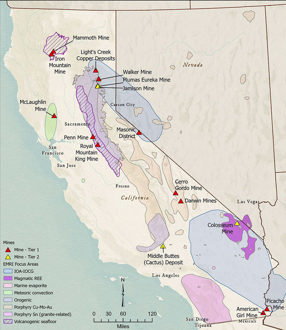 2025 Inventory for Mines with Critical Mineral Potential in Waste - in progress.
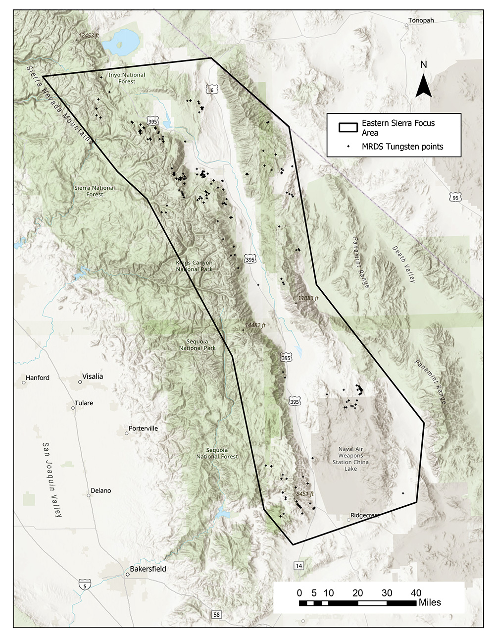
Eastern Sierra Geochemical Reconnaissance - in progress
This Earth MRI project proposes new geochemical reconnaissance mapping in the eastern Sierra Nevada, the White and Inyo Mountains, the Benton Range, and the Argus Range. More ❯
 Eastern Sierra Geochemical Reconnaissance - in progress.
National Geological and Geophysical Data Preservation Program Projects
The U.S. Geological Survey's National Geological and Geophysical Data Preservation Program (NGGDPP) aims to preserve and provide access to geological, geophysical, and engineering data, maps, and samples. Through the NGGDPP, the USGS provides technical and financial assistance to state geological surveys to preserve these geoscientific collections.
View and Download the NGGDPP Projects
Critical Minerals Inventory
This dataset represents the occurrences of four critical minerals (cobalt, lithium, platinum group elements, and tungsten) in historic CGS publications and select USGS publications. More ❯
Future work will expand this dataset to capture information on additional critical minerals.
 Critical Minerals Inventory.
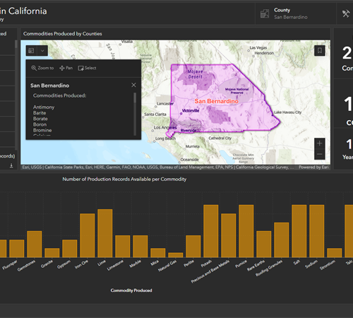
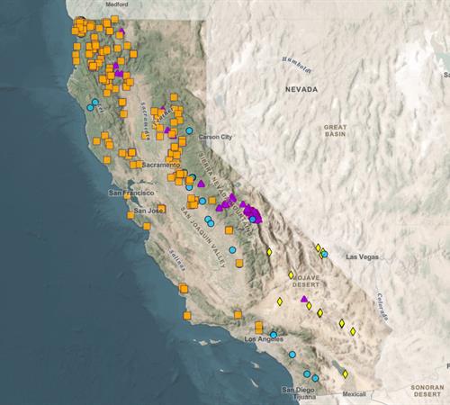
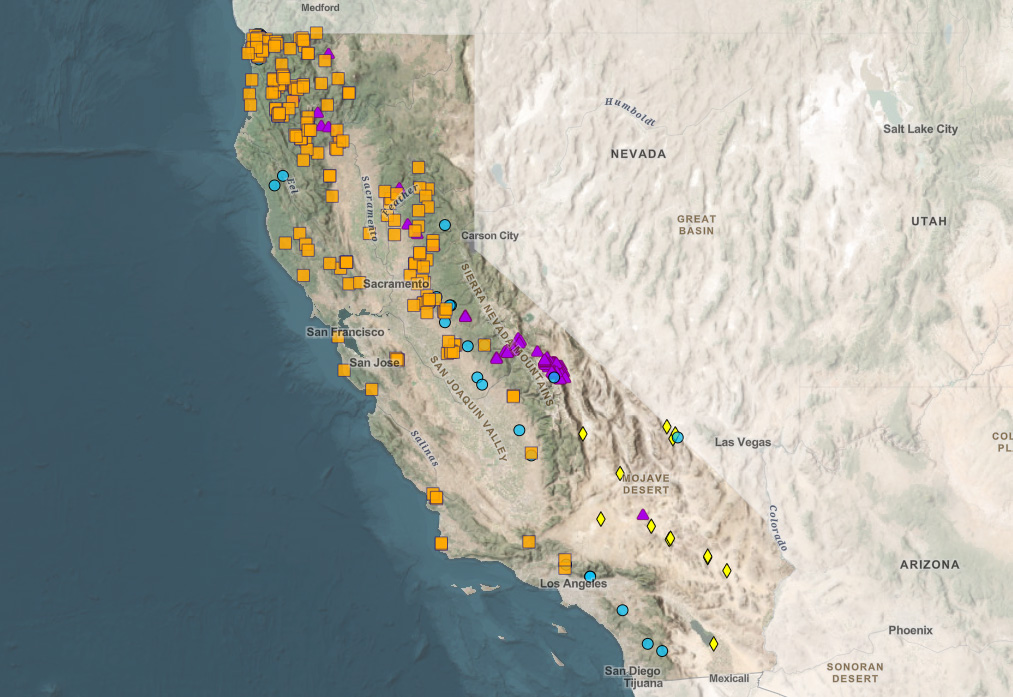
Historical Mineral Production in California
This project details the annual mineral production information collected by the CGS from the years 1962 through 1969. Additional archiving is ongoing. More ❯
Select the image below to explore the Historical Mineral Production in California Dashboard:
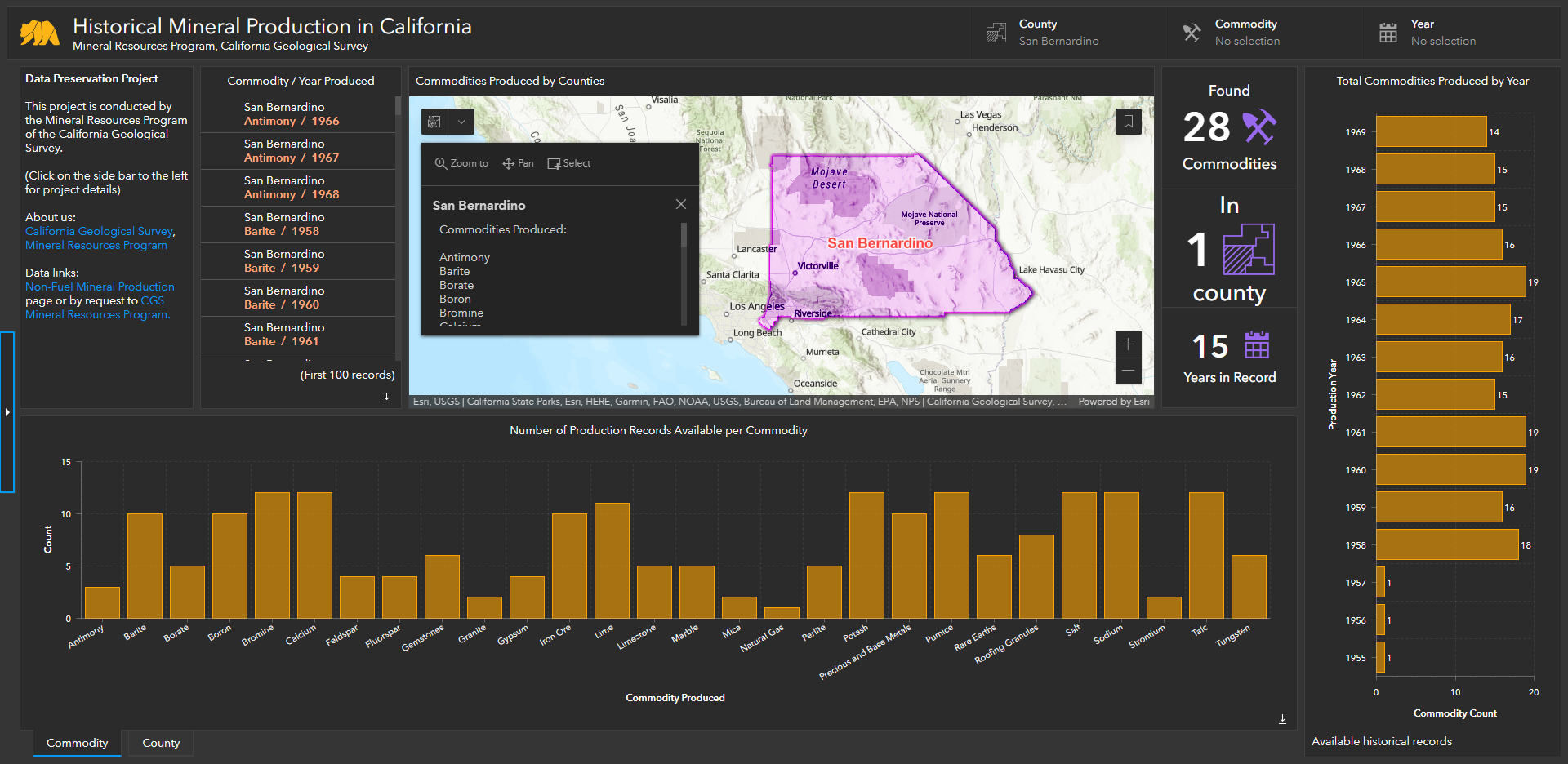 The California Historical Mineral Production interactive data dashboard. Select the image to open the dashboard in a new window.
Statewide Geochemistry Reconnaissance Projects
The MRP is conducting a statewide geochemical survey to better understand the distribution of critical minerals across the state. The MRP targets areas with known critical mineral occurrences and publishes the geochemical results. Geochemical sampling is ongoing.
View and Download Statewide Geochemistry Reconnaissance Projects
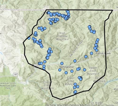
Statewide Geochemical Reconnaissance
The CGS conducted geochemical reconnaissance sampling of laterite and associated ultramafic rocks in Del Norte County as part of its statewide geochemical reconnaissance initiative. More ❯
The Del Norte County laterite deposits have historically been mined for nickel, cobalt, and chromium.
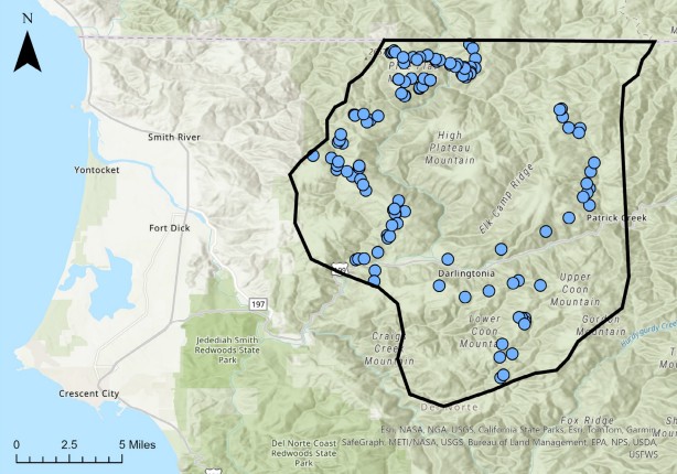 Del Norte geochemical reconnaissance
Web page by:
California Geological Survey - Mineral Resources Program
