Basic geologic mapping is the foundation for any comprehensive study undertaken to evaluate earth science related societal and environmental issues. The Geologic Mapping Program was established to prepare and maintain a baseline source of the most current information on the framework geology of California. CGS geologists map and compile geologic maps of the state and its offshore continental margin at various scales.
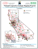
The Geologic Mapping Program works in cooperation with the U.S. Geological Survey (USGS) through STATEMAP and SCAMP.
-
STATEMAP is a cooperative geologic mapping program funded by the USGS through the National Mapping Act. Funding is provided for successful proposals to participating states for the explicit purpose of developing digital geologic maps for areas shown to have significant societal needs. States awarded funding are required to provide matching funds.
-
SCAMP is a cooperative project between the U.S. Geological Survey and the California Geological Survey. The project provides geologic-information products for public access--including geologic maps and databases, geophysical maps, and topical reports that describe the geologic setting and geologic history of Southern California.
Geologic mapping priorities are established under the direction of the State Geologist and the California Geologic Mapping Advisory Committee.
Products of the RGLMP
Products include statewide 1:750,000-scale geologic and fault activity maps; 1:250,000-scale geologic atlas and regional geologic map series and offshore continental margin maps; 1:100,000 and 1:24,000-scale quadrangle maps of selected areas of the state. Other products include indexes to geologic mapping and graduate theses.
Regional Geologic Maps
CGS Regional Geologic maps are available in the following sizes and scales:
Landslide Maps
Visit our Landslides page for information on landslide mapping products.
Continental Margin Maps (1:250,000 scale)
Nearly complete coverage of off-shore areas. Continental Margin Maps are currently not available for download; please contact CGS Publications to obtain Continental Margin Maps.
Related Links
