Geology and Landslides in Selected North Coast Quadrangles
of Northern California
Description of Digital Contents
This data set contains PDFs of the scanned versions of both the paper and mylar copies of the 1:62,500 and 1:24,000 scale quadrangles mapped under the California Department of Forestry’s Title II Geologic Data Compilation Project of 1979 (Figures 1-4).
Background
In 1979, the California Department of Forestry (CDF), now the California Department of Forestry and Fire Protection (CalFIRE), hired several geologists to compile existing geologic and landslide data on timberlands along California’s north coast. Work was completed under the direction of the California Division of Mines and Geology (CDMG), now the California Geological Survey (CGS). The project, known as the Title II Geologic Data Compilation Project, encompassed more than 70 topographic quadrangles from Del Norte County south to Santa Cruz County (Figures 1-4). Geologic and landslide data were compiled at a scale of either 1:62,500 (north of San Francisco) or 1:24,000 (south of San Francisco). The purpose of the compilation was to assist CDF with the identification of non-point sources of sediment pollution from landslides along watercourses within proposed Timber Harvesting Plans. Although data was preliminary in some areas and mapped inconsistently, the maps provided a broad-scale overview of where certain types of geologic terrain might present slope stability and/or erosion problems that should be addressed on the ground. More recent and more detailed mapping has been done in many of the quadrangles originally covered in the Title II Compilation. However, in some remote places, these maps are still the only geologic information available. For additional information on this project, please see the
CGS OFR 79-18 project report. For additional information on data quality and limitations, please see the
Title II Description of Digital Contents document.
Ukiah and Santa Rosa Region Page
Click on the Name Below to Jump to That Region
Overview Map of the Project Area Showing USGS Quads
Simplified Index Map of Topographic Maps of California within each 1:250,000-Scale Map Sheet. Quadrangles in the Title II Project are highlighted.
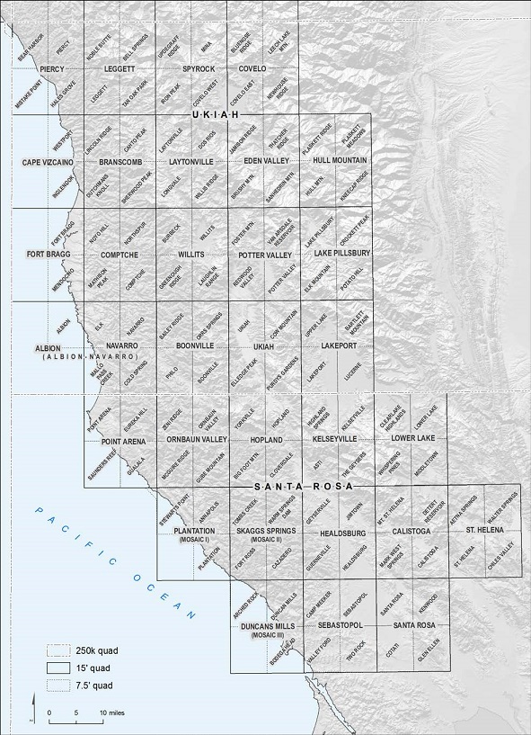
Index Map of 15-Minute Quadrangles in the Compilation of the Ukiah and Santa Rosa Sheets.
Ukiah and Santa Rosa
