Maps are provided in PDF format. A large format plotter (minimum 36" width) is required to print these maps.
DISCLAIMER:
The State of California and the Department of Conservation make no representations or warrantees regarding the accuracy of the data from which these maps were derived. Neither the State nor the Department shall be liable under any circumstances for any direct, indirect, special, incidental or consequential damages with respect to any claim by any user or any third party on account of or arising from the use of these maps.
The identification and location of landslide hazard areas are based on review of limited aerial photographs that are listed on each specific map. In most cases, only two sets of aerial photographs were used to construct the landslide and geomorphic features maps. Due to time constraints all available data were not necessarily reviewed and used in construction of these maps. The quality of data used is varied. The information depicted on the maps has been drawn as accurately as possible at 1:24,000 scale. The maps and reports provided on this web site are subject to change without notice, and the latest available versions will be posted on this web site.
Information on the maps are not sufficient to serve as a substitute for site specific geologic and geotechnical site investigations as required under the Chapters 7.5 and 7.8 of Division 2 of the Public Resources Code.
By DOWNLOADING FILES FROM THE CGS FWGP WEB SITE,
you acknowledge that you have read THE disclaimer
ABOVE AND THAT YOU ACCEPT ITS CONDITIONS
Maps (PDF)
| Maps |
Description |
Scale |
Download |
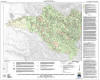  |
Watershed Mapping Series, Map Set 1, Map of Geologic and Geomorphic Features Related to Landsliding (color), Noyo River Watershed, Mendocino County, California
(West and east sheets) |
1:24,000 |
NOYO COLOR WEST
(PDF 6.42MB)
NOYO COLOR EAST
(PDF 10.9MB) |
 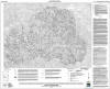 |
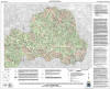
Watershed Mapping Series, Map Set 1, Map of Geologic and Geomorphic Features Related to Landsliding (black-and-white), Noyo River Watershed, Mendocino County, California
(West and east sheets) |
1:24,000 |
NOYO BW WEST
(PDF 6.24MB)
NOYO BW EAST
(PDF 10.6MB) |
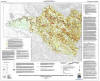 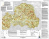 |
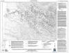
Watershed Mapping Series, Map Set 1, Landslide Potential Map with Geologic and Geomorphic Features, Noyo River Watershed, Mendocino County, California
(West and east sheets) |
1:24,000 |
NOYO POTENTIAL WEST
(PDF 7.51MB)
NOYO POTENTIAL EAST
(PDF 12.1 MB) |
