This page provides links to download geologic maps of the Jackson Demonstration State Forest in Mendocino County, California. The maps are in portable document format (PDF). PDF viewing software such as
Adobe Reader® is required to view them. A large format plotter (minimum 36" width) is required to print the maps at their designed size.
Disclaimer
The State of California and the Department of Conservation make no representations or warranties regarding the accuracy of the data from which these maps were derived. Neither the State nor the Department shall be liable under any circumstances for any direct, indirect, special, incidental or consequential damages with respect to any claim by any user or any third party on account of or arising from the use of these maps. The identification and location of landslide hazard areas are based on review of limited aerial photographs that are listed on each specific map. In most cases, only two sets of aerial photographs were used to construct the landslide and geomorphic features maps. Due to time constraints all available data were not necessarily reviewed and used in construction of these maps. The quality of data used is varied. The information depicted on the maps has been drawn as accurately as possible at 1:24,000 scale. The maps and reports provided on this web site are subject to change without notice, and the latest available versions will be posted on this web site. Information on the maps are not sufficient to serve as a substitute for site specific geologic and geotechnical site investigations as required under the Chapters 7.5 and 7.8 of Division 2 of the Public Resources Code.
Map Downloads
By downloading these maps, you acknowledge that you have read the disclaimer above and that you accept its conditions.
To download a map, right-click on its link and select "Save Target As..." (or "Save Link As..."). If you would rather view a PDF online, simply click once on its link.
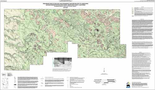
Preliminary Map of Geologic and Geomorphic Features Related to Landsliding
Color version (7.61 MB)
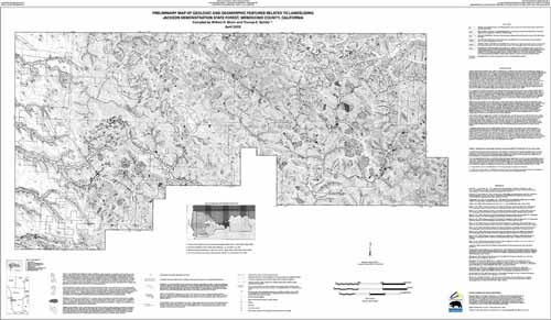
Preliminary Map of Geologic and Geomorphic Features Related to Landsliding
Black and white version (7.32 MB)
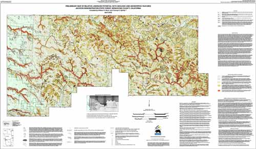
Preliminary Map of Landslide Potential with Geologic and Geomorphic Features (9.79 MB)