The 2010 Geologic Map of California and the Fault Activity Map of California were prepared in recognition of the California Geological
Survey’s 150th Anniversary. Both are all-digital products built on the original compilations of C.W. Jennings published in 1977 and 1994. The digital version of the Jennings (1977) geologic map was released in 2000 (Saucedo and others, 2000) and serves as the base digital geologic data layer for the geologic map with additions and modifications described below. These editions remove, as much as possible, distortions in the previous digital versions that were inherited from the composite base map of the original printed versions.
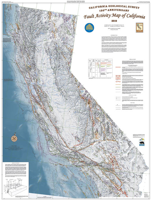
The 2010 Fault Activity Map of California presents a much more detailed depiction of faults in California than previous versions. Faults active in the Quaternary (2.6 Ma) were digitized from their original sources in order to preserve as much of the original detail as possible. Similar to the 1994 Fault Activity Map, the 2010 map is accompanied by an extensive listing of the sources of fault maps and age determinations. In the 2010 Fault Activity Map, the faults are depicted in as much detail as possible at the scale of the map.
Click
here to view a larger image of the Fault Activity Map of California. (2.6 MB jpeg file)
Click
here or on/near the San Francisco bay area for a closer look at the map.
Click
here to view the interactive map on your browser.
Click
here to view the Pamphlet that accompanies the Fault Activity Map of California.
NOTE: The 2010 Fault Activity Map of California is available for purchase through our
CGS Publications office as a printed poster size hardcopy map
(47¼“ x 62½“) accompanied by the explanatory text pamphlet.