On January 17, 1994, at 4:31 a.m. PST, a magnitude 6.7 earthquake centered in Northridge struck the southern California area. Known as the Northridge Earthquake, it caused at least 57 fatalities (a subsequent study put the death toll at 72, including heart attacks) and injured thousands. The earthquake caused up to $20 billion in damage costs, plus $40+ billion in economic loss, making it the costliest earthquake disaster in U.S. history.
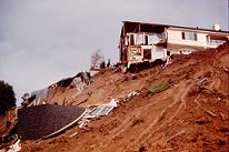 Intense ground shaking generated widespread ground failures in the region. During the earthquake, CGS ground motion instruments recorded horizontal accelerations of 1.25g and vertical accelerations of 1.2g (1g = force of gravity). Thousands of landslides occurred throughout the mountains surrounding the San Fernando Valley and as far north as Castaic Lake. Widespread liquefaction (saturated soil that behaves as a liquid when shaken) was triggered as far away as the Port of Los Angeles, some 30 miles from the epicenter. These types of ground failures caused severe damage to building foundations and to vital lifeline infrastructure (transportation corridors, water, gas, and electric transmission facilities).
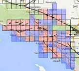
As a consequence of the severe losses caused by this event, the Federal Emergency Management Agency (now under the U.S. Department of Homeland Security) awarded the California Geological Survey nearly $20 million to accelerate the zoning of earthquake hazards under the Seismic Hazards Mapping Act of 1990. These Seismic Hazard Zones, or Zones of Required Investigation, delineate where there is a high likelihood of these hazards occurring in future earthquake events. Local city and county permitting agencies are required to request “special geological and engineering studies” be performed within these zones prior to land development and construction.
 Once special studies are performed by qualified engineers and geologists, measures to physically mitigate these ground-failure hazards are included in the development plans before permits are issued. Recognizing and fixing these potential problems before development occurs is the most cost-effective way to deal with these earthquake hazards. Reducing the impact of these ground-failure hazards, not only save lives and property during future earthquakes, but leads to more sustainable economic communities.
Since the Northridge event, over 6,000 square miles of land covering the greater Los Angeles Metropolitan Area, including all of Orange County and half of Ventura County, and portions of the San Francisco Bay Area have been zoned under the Act. This area includes more than 150 incorporated cities and developing county lands that have an aggregate population exceeding 12 million people, and an average annual construction volume of over $10 billion. These communities are now benefiting from safer development.
The Seismic Hazards Program at CGS continues to produce similar maps throughout California.
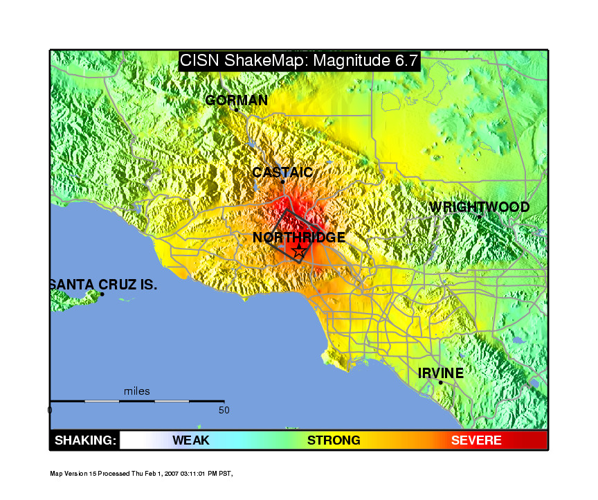
BELOW: A ShakeMap of the 1994 Northridge earthquake. A ShakeMap is a near-real-time seismic network product that helps guide emergency response efforts within minutes of a strong earthquake. The California Strong Motion Instrumentation Program (CSMIP), a CGS program, manages more than 1,300 strong motion instruments statewide that contribute data to ShakeMap.
Visit the California Integrated Seismic Network to see the 1994 Northridge earthquake ShakeMap and related products.