Documenting greater detail within the 'Other Land' categoryThe Rural Land Mapping project was undertaken to better characterize conversions affecting agricultural land that are not due to urbanization. This type of conversion affects one out of every five acres removed from crop or grazing land uses. Examples include conversions to gravel mining, wetlands, low-density residential development, or to agriculturally related uses such as confined animal agriculture or compost facilities. The project began in 2002 with four pilot counties and has expanded in the 2006 data to include all eight San Joaquin Valley counties in the FMMP survey area. The work involves subdividing the miscellaneous Other Land map classification into five new categories, as described below. Data is available in GIS format, as PDF maps, and as statistics (XLSX format, search by county).
A more detailed description of the project's findings to date is also available upon request.
Rural Land Mapping Categories
| Photo Example
|
|---|
| Rural Residential Land | Residential areas of 1 to 5 structures per 10 acres ('ranchettes'). |  | Semi-agricultural and Rural Commercial Land
| Farmsteads, agricultural storage and packing sheds, unpaved parking areas, composting facilities, equine facilities, firewood lots, and campgrounds. | 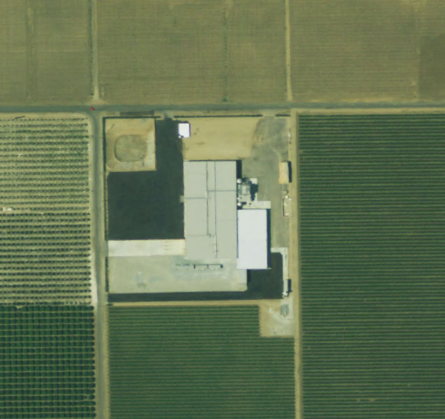 | | Vacant or Disturbed Land | Open field areas that do not qualify as an agricultural category, mineral and oil extraction areas, off road vehicle areas, electrical substations, channelized canals, and rural freeway interchanges. |  | | Confined Animal Agriculture | Poultry facilities, feedlots, dairy facilities, fish farms - this use may be a component of Farmland of Local Importance in some counties. |  | | Nonagricultural or Natural Vegetation | Heavily wooded, rocky/barren areas, riparian and wetland areas, grassland areas which do not qualify as Grazing Land due to their size or land management restrictions, small water bodies and recreational water ski lakes. Constructed wetlands are also included in this category. |  | | Please note: these classes are not designed for interpretation as 'habitat'. Differences between vacant/disturbed land and nonagricultural/natural vegetation are a function of level of disturbance, relative location, and time period since disturbance occurred. |
FMMP initiated this project because of requests from the user community and we hope to design a product that meets your needs yet is fiscally practical. Please email FMMP if you have questions or comments about the Rural Land Mapping project.
Rural Land Mapping Project Links
|
