Preliminary Earthquake Fault Zones
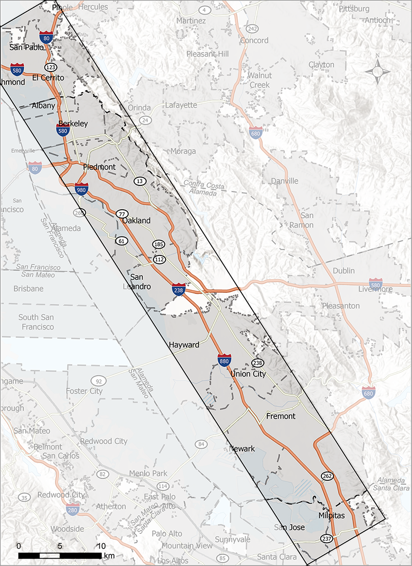
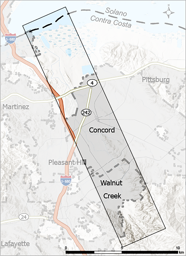 Index maps showing the general areas affected by the Earthquake Fault Zones in this release. Click an image to open a larger version in a new window.
MAY 21, 2026 – The California Geological Survey released new technical reports describing preliminary Alquist-Priolo Earthquake Fault Zones for public review. The zones in this release affect the cities of Berkeley, Concord, El Cerrito, Fremont, Hayward, Milpitas, Oakland, Richmond, San Leandro, San Pablo, Union City, Walnut Creek, and the counties of Alameda, Contra Costa, and Santa Clara.
- Preliminary Fault Evaluation Report 267: The Hayward Fault in Contra Costa, Alameda, and Santa Clara Counties, California
- Preliminary Fault Evaluation Report 276: The Concord Fault Zone in Contra Costa County, California
The reports, which include maps of the preliminary zones, are available as PDF files. To download them, click the button provided below.
NOTE: Clicking the button will redirect you to the California Department of Conservation's FileRequest site, where you must select the reports you want, then provide an email address where we will send you perishable links for downloading the reports.
Related Reference Material
- Reference Guide for Assessing Fault Rupture Hazards (Special Publication 42: Earthquake Fault Zones - A Guide for Government Agencies, Property Owners/Developers, and Geoscience Practitioners for Assessing Fault Rupture Hazards in California). This document contains technical guidelines for evaluating surface fault rupture hazards and for reviewing geologic reports.
Preliminary Seismic Hazard Zones
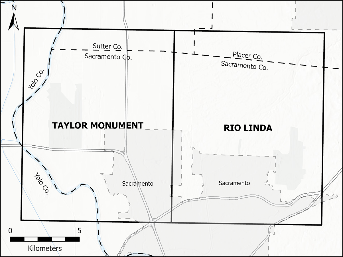 Index maps showing the general areas affected by the Seismic Hazard Zones in this release. Click an image to open a larger version in a new window.
MAY 21, 2026 – The California Geological Survey released new technical reports describing preliminary Seismic Hazard Zones for public review. The zones in this release affect the cities of Cotati, Petaluma, Rohnert Park, Sacramento, and the counties of Alameda, Contra Costa, Placer, Sacramento, Sonoma, Sutter, and Yolo.
- Preliminary Seismic Hazard Zone Report 144: Seismic Hazard Zone Report for the Tassajara 7.5-Minute Quadrangle, Contra Costa and Alameda Counties, California
- Preliminary Seismic Hazard Zone Report 145: Seismic Hazard Zone Report for the Cotati 7.5-Minute Quadrangle, Sonoma County, California
- Preliminary Seismic Hazard Zone Report 146: Seismic Hazard Zone Report for the Taylor Monument and Rio Linda 7.5-Minute Quadrangles, Placer, Sacramento, Sutter and Yolo Counties, California
The reports, which include maps of the preliminary zones, are available as PDF files. To download them, click the button provided below.
NOTE: Clicking the button will redirect you to the California Department of Conservation's FileRequest site, where you must select the reports you want, then provide an email address where we will send you perishable links for downloading the reports.
Related Reference Material
- Reference Guide for Evaluating Seismic Hazards (Special Publication 117A: Guidelines for Evaluating and Mitigating Seismic Hazards in California). This document constitutes the guidelines for evaluating seismic hazards other than surface fault rupture, and for recommending mitigation measures as required by Public Resources Code Section 2695(a).
