Highway Corridor Landslide Hazard Mapping

​​The California Geological Survey (CGS) has developed highway corridor landslide hazard maps to meet the needs of engineers, geologists, planners, and maintenance staff of the California Department of Transportation (Caltrans). The project was initiated after the 1997 Mill Creek Slide closed a portion of U.S. Highway 50 for approximately one month. Maps prepared by CGS as part of the emergency response and recovery from the 1997 incident now serve as a planning and maintenance document for developing long-term mitigation strategies.

Recognizing the value of this product, Caltrans contracted with CGS to develop a series of maps of selected California highway corridors within a variety of climatological and geological settings. The maps provide an inventory of landslide activity along the selected highway corridors. This “big picture” perspective will benefit planning of route improvements and lead to more effective landslide risk mitigation for California's highways.

Each of the reports prepared under this project includes a description of the geologic materials along the highway corridor, the distribution and types of landslides, and the potential impacts of landslides on the highway. Geologic and landslide inventory maps are included in each report. In most reports, Plate 1 (the geologic map) and Plate 2 (the landslide map) are formatted into map sections that can be downloaded and printed on 11"x17" sheets of paper.

Accessibility Statement: The California Geological Survey is committed to and is making every possible effort to ensure that all electronic and information technology developed, procured, maintained, or used by the Survey is accessible to people with disabilities, including both our employees and the customers we serve. If you cannot access the information in our documents, please contact our headquarters at cgshq@conservation.ca.gov, and we will provide the information to you in an alternate format (for example Microsoft Word doc, Microsoft Excel xls, rich text format, text only, and so on). To enable us to respond in a manner that will be of most help to you, please indicate the Title of the document, the Web address where you obtained the document, the nature of the accessibility problem, and your contact information so we can reach you if questions arise while fulfilling your request.

Special Report 243 - Landslide Hazard Mapping for Selected California Highway Corridors, Phase 2

Large rock on roadway dwarfs adjacent vehicle.

by C.J. Wills, W.D. Haydon, B.J. Swanson, F.G. Perez, C.I. Gutierrez, and J.T. Lancaster, 2019, California Geological Survey, 340 pages + 45 plates (oversize maps).

The potential for landslide damage to highways in California is concentrated in areas where several aspects of the geology and geography converge to make landslide movement more likely. Landslide inventory maps are a key step supporting an analysis of the potential risks to highways from landslides. Additional information on landslide hazards can be gained by summarizing the geologic materials and the slopes within the highway corridors. Each highway corridor is divided into sections based on similarities in the bedrock geology, slopes, and size, type, and activity of landslides. The report chapters summarize where a combination of factors lead to increased potential for landslides and provide information on the potential consequences to the roadway if a landside were to activate.

This Phase 2 report adds roughly 277 miles of landslide mapping, bringing the total of the Caltrans Highway Corridor Landslide Mapping project to 465 miles of state highways. These maps and descriptions of the factors leading to areas of high landslide potential assist Caltrans in planning for long-term landslide hazard mitigation and support slide-aware maintenance practices along these highway corridors.

Chapter 1: Project Overview and Standard Methodology (2.8 MB)

[No Plates in Chapter 1]

Chapter 2: Landslide Hazards along Route 101 and Route 162, Mendocino and Humboldt Counties, California (1 MB)

Chapter 2 Plates: Download them individually from the list below, or download all Chapter 2 Plates as one file (CAUTION: this file is 199 MB)

Chapter 3: Landslide Hazards along Route 1, Marin County, California (1 MB)

Chapter 3 Plates: Download them individually from the list below, or download all Chapter 3 Plates as one file (36.3 MB)

Chapter 4: Landslide Hazards along Route 84, Alameda County, California (2 MB)

Chapter 4 Plates: Download them individually from the list below, or download all Chapter 4 Plates as one file (50.3 MB)

Chapter 5: Landslide Hazards along Route 17 and Route 35, Santa Cruz and Santa Clara Counties, California (1 MB)

Chapter 5 Plates: Download them individually from the list below.

Chapter 6: Landslide Hazards along Route 144, Santa Barbara County, California (1 MB)

[No Plates in Chapter 6]

Chapter 7: Landslide Hazards along Route 150, Route 23, and Route 126, Ventura and Los Angeles Counties, California (1 MB)

Chapter 7 Plates: Download them individually from the list below, or download all Chapter 7 Plates as one file (41.3 MB)

Chapter 8: Landslide Hazards along Route 1, Route 23, Route 27, and Route 101, Ventura and Los Angeles Counties, California (1.1 MB)

Chapter 8 Plates: Download them individually from the list below, or download all Chapter 8 Plates as one file (CAUTION: this file is 115 MB)

Chapter 9: Landslide Hazards along Route 57 and Route 142, Los Angeles, and San Bernardino Counties, California (1 MB)

Chapter 9 Plates: Download them individually from the list below.

Chapter 10: Landslide Hazards along Route 241 and Route 261, Orange County, California (1.3 MB)

Chapter 10 Plates: Download them individually from the list below.

Chapter 11: Landslide Hazards along Route 73, Orange County, California (1.2 MB)

Chapter 11 Plates: Download them individually from the list below.

Optional: Bundled downloads of Chapters and Plates

Download all SR 243 Chapters (10.4 MB)

Download all SR 243 Plates (CAUTION: this file is 627 MB)

Special Report 184 - Landslides in the Highway 101 Corridor between Wilson Creek and Crescent City, Del Norte County, California

Highway 101 parallels the Pacific coast in Del Norte county.

by C.J. Wills, 2000, California Geological Survey, 24 pgs.

Download Special Report 184 (1.8 MB)

Special Report 185 - Landslides in the Highway 1 Corridor: Geology and Slope Stability along the Big Sur Coast between Point Lobos and San Carpoforo Creek, Monterey and San Luis Obispo Counties, California

Highway 1 traverses steep hillsides along the Big Sur coast.

by C.J. Wills, M.W. Manson, K.D. Brown, C.W. Davenport and C.J. Domrose, 2001, California Geological Survey, 40 pgs.

Download Special Report 185 (1.1 MB)

SR 185 Plate 1: Geology of the Highway 1 Corridor, Monterey and San Luis Obispo Counties, California

  • Plate 1 Explanation
  • Plate 1, Map 1: Burro Mountain and Villa Creek
  • Plate 1, Map 2: Burro Mountain, Villa Creek and Cape San Martin
  • Plate 1, Map 3: Villa Creek and Cape San Martin
  • Plate 1, Map 4: Cape San Martin, Cone Peak and Lopez Point
  • Plate 1, Map 5: Cape San Martin, Cone Peak and Lopez Point
  • Plate 1, Map 6: Lopez Point
  • Plate 1, Map 7: Lopez Point and Partington Ridge
  • Plate 1, Map 8: Partington Ridge
  • Plate 1, Map 9: Partington Ridge, Pfeiffer Point and Big Sur
  • Plate 1, Map 10: Pfeiffer Point and Big Sur
  • Plate 1, Map 11: Big Sur and Point Sur
  • Plate 1, Map 12: Point Sur and Soberanes Point
  • Plate 1, Map 13: Soberanes Point
  • Plate 1, Map 14: Soberanes Point and Monterey

SR 185 Plate 2: Landslides in the Highway 1 Corridor, Monterey and San Luis Obispo Counties, California

  • Plate 2 Explanation
  • Plate 2, Map 1: Burro Mountain and Villa Creek
  • Plate 2, Map 2: Burro Mountain, Villa Creek and Cape San Martin
  • Plate 2, Map 3: Villa Creek and Cape San Martin
  • Plate 2, Map 4: Cape San Martin, Cone Peak and Lopez Point
  • Plate 2, Map 5: Cape San Martin, Cone Peak and Lopez Point
  • Plate 2, Map 6: Lopez Point
  • Plate 2, Map 7: Lopez Point and Partington Ridge
  • Plate 2, Map 8: Partington Ridge
  • Plate 2, Map 9: Partington Ridge, Pfeiffer Point and Big Sur
  • Plate 2, Map 10: Pfeiffer Point and Big Sur
  • Plate 2, Map 11: Big Sur and Point Sur
  • Plate 2, Map 12: Point Sur and Soberanes Point
  • Plate 2, Map 13: Soberanes Point
  • Plate 2, Map 14: Soberanes Point and Monterey

Special Report 186 - Landslides in the Highway 60 Corridor in the San Timoteo Badlands, Riverside County, California

Highway 60 cuts through rugged terrain in Riverside county.

by M.W. Manson, C.W. Davenport, K.D. Brown, C.J. Wills, and C.J. Domrose, 2002, California Geological Survey, 21 pgs.

Download Special Report 186 (1.4 MB)

SR 186 Plate 1: Geologic Map of the Highway 60 Corridor, Riverside County, California

SR 186 Plate 2: Landslide Map of the Highway 60 Corridor, Riverside County, California

Special Report 187 - Landslides in the Highway 101 Corridor between Leggett and Piercy, Mendocino County, California

A landslide covers part of Highway 101 in Mendocino county.

by M.W. Manson, C.W. Davenport, C.J. Domrose and C.J. Wills, 2003, California Geological Survey, 32 pgs.

Download Special Report 187 (3.3 MB)


Special Report 188 - Landslides in the Interstate 5 Corridor between Valencia and Gorman, Los Angeles County, California

Interstate 5 traverses ruggen barren terrain in northern Los Angeles county.

by B.D. Foster, 2003, California Geological Survey, 23 pgs.

Download Special Report 188 (1 MB)

Special Report 195 - Landslides in the Highway 299 Corridor Between Blue Lake and Willow Creek, Humboldt County, California
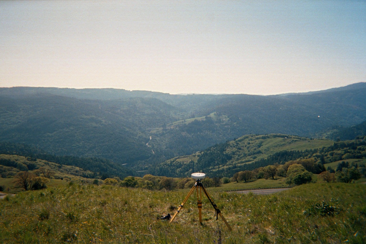
A surveyor's tripod erected on a hillside above Highway 299 in Humboldt county.

by J.N. Falls, C.J. Wills and B.C. Hardin, 2006, California Geological Survey, 59 pgs

Highway 299 is a major transportation corridor in northern coastal California and traverses a particularly rugged and landslide-prone area between Blue Lake and Willow Creek in Humboldt County. Within this corridor, landslides at Berry Summit have been an ongoing problem for decades. Movements in the 1990’s necessitated consideration of several large and complex mitigation options. In order to evaluate these options, and the relative hazards of the landslides compared with others in the area, CalTrans contracted with the California Geological Survey to map the geology and landslides of the corridor. This mapping will help CalTrans plan landslide mitigation along the existing roadway and evaluate potential means of avoiding the most severe hazards.

In this report, the results of the LiDAR survey have been used to prepare landslide maps in the same format as other highway corridor maps. This report also presents conclusions on the effectiveness of the LiDAR survey in improving the accuracy and completeness of the landslide mapping.

Download Special Report 195 (3.5 MB)

SR 195 Plate 1: Geologic Map of the Highway 299 Corridor, Humboldt County, California

Plate 1, Sheet 1 of 2 (Western Portion) (22 MB)

Plate 1, Sheet 2 of 2 (Eastern Portion) (20 MB)

SR 195 Plate 2: Landslide Map of the Highway 299 Corridor, Humboldt County, California

Plate 2, Sheet 1 of 2 (Western Portion) (22 MB)

Plate 2, Sheet 2 of 2 (Eastern Portion) (21 MB)


Special Report 196 - Landslides in the Highway 1 Corridor between Bodega Bay and Fort Ross, Sonoma County, California

Highway 1 traverses steep hillsides in Sonoma county.

by M.W. Manson, C.M. Huyette, C.J. Wills, M.E. Huffman, M.G. Smelser, M.E. Fuller, C. Domrose and C. Gutierrez, 2006, California Geological Survey, 26 pgs

Highway 1, the main transportation corridor along the coast in northern California, traverses a particularly rugged and landslide-prone area between Bodega Bay and Fort Ross in Sonoma County. Within this corridor, landslides on the high steep slopes between Russian Gulch and Fort Ross have been an ongoing problem for decades. Movements in the 1990’s necessitated construction of several large structures to attempt to stabilize landslides. In order to evaluate the relative hazards of the landslides along the highway on the high bluffs compared with other landslides in the area, Caltrans contracted with the California Geological Survey to map the geology and landslides of the corridor. This mapping will help Caltrans plan landslide mitigation along the existing roadway and evaluate potential means of avoiding the most severe hazards.

Two sets of maps have been prepared for this corridor, a landslide inventory map and a geologic map. The maps were prepared at a scale of 1:12,000 by compilation of previous geologic mapping, interpretation of aerial photographs and original field mapping along the highway. These maps were prepared using a computer geographic information system (GIS) on scanned images of USGS 7.5-minute topographic quadrangles. Portions of the Arched Rock, Bodega Bay, Duncans Mills, Fort Ross and Plantation quadrangles form the base maps.

Download Special Report 196 (1 MB)